
Ach isn’t Argyll bonnie? Here at Loch Lomond Holiday Park, we want you to make the most of our spectacular surroundings, so we’ve compiled a selection of walking trails for you to enjoy while you’re here. Ranging from 20-minute strolls, to longer daunders, there is something to suit everyone and their four-legged friends. Each unique trail offers an opportunity to get closer to nature, so choose your route, fasten your boots and get walking.
Whilst walking near Loch Lomond Holiday Park, you can expect to stumble upon braw views across Loch Lomond and the islands – so don’t forget yer camera and tag us in your Instagram posts (@argyllholidays) we love seeing what you’ve been up to!
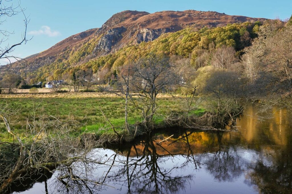
Doon Hill and Fairy Knowe
Distance: 6.5km
Time – 2 hours
- When you arrive in Aberfoyle follow signs for parking at the Scottish Wool Centre.
- Begin at the far end of the car park, turn left to cross the old bridge over the River Forth and follow this road passing some houses on the right and Aberfoyle Cemetery on the left.
- As you stroll you will spot Kirkton Church where the grave of Reverend Robert Kirk can be found. The Reverend Kirk was the first minister here between 1685 and 1692 here and he was interested in local folklore and superstitions.
- Continue to follow the road as it bends round to the right and crosses beautiful Scottish countryside. Keep left at the fork in the road, which is signposted for Doonhill Trail, continuing past a house. Follow the road as it becomes a rougher track – the route is marked in green and blue. As the track narrows, head slightly downhill where you will pass a green metal gate.
- Turn left at the junction beyond, and then look out for a green waymarked path veering right. This path will lead you up through the woods of Doon Hill. Legend has it that the fairies, fed up with Rev Kirk’s revelations about them, kidnapped him and encased his soul in the pine tree on top of the hill.
- Just before the summit the green waymarked path heads off right. First visit the great tree on the top of the hill where you will find clouties (rags) which have been hung by passers by in the belief that they will get rid of any illnesses.
- Begin your descent by following the green waymarked path which leads down to the right. When you reach a track, turn left and following blue markers for the rest of the walk.
- After a while the track crosses a bridge and turns left at a junction, follow this track across open ground and enjoy amazing views of Doon Hill to the left. Follow the path waymarked in green which veers off to the right and climb uphill until you reach a bend in the track where you will take a sharp left. The path then continues through the trees and crosses a wooden boardwalk.
- After a short ascent the path eventually heads downhill again and emerges onto a track where you will turn right and pass a metal barrier before taking a sharp left to follow the patch upstream with a river on your right.
- When you meet a path at a T-junction, turn right. Further on you will turn right at another junction to cross an arched wooden footbridge. Beyond this you will come across the old railway line where you will turn left and head back towards Aberfoyle.
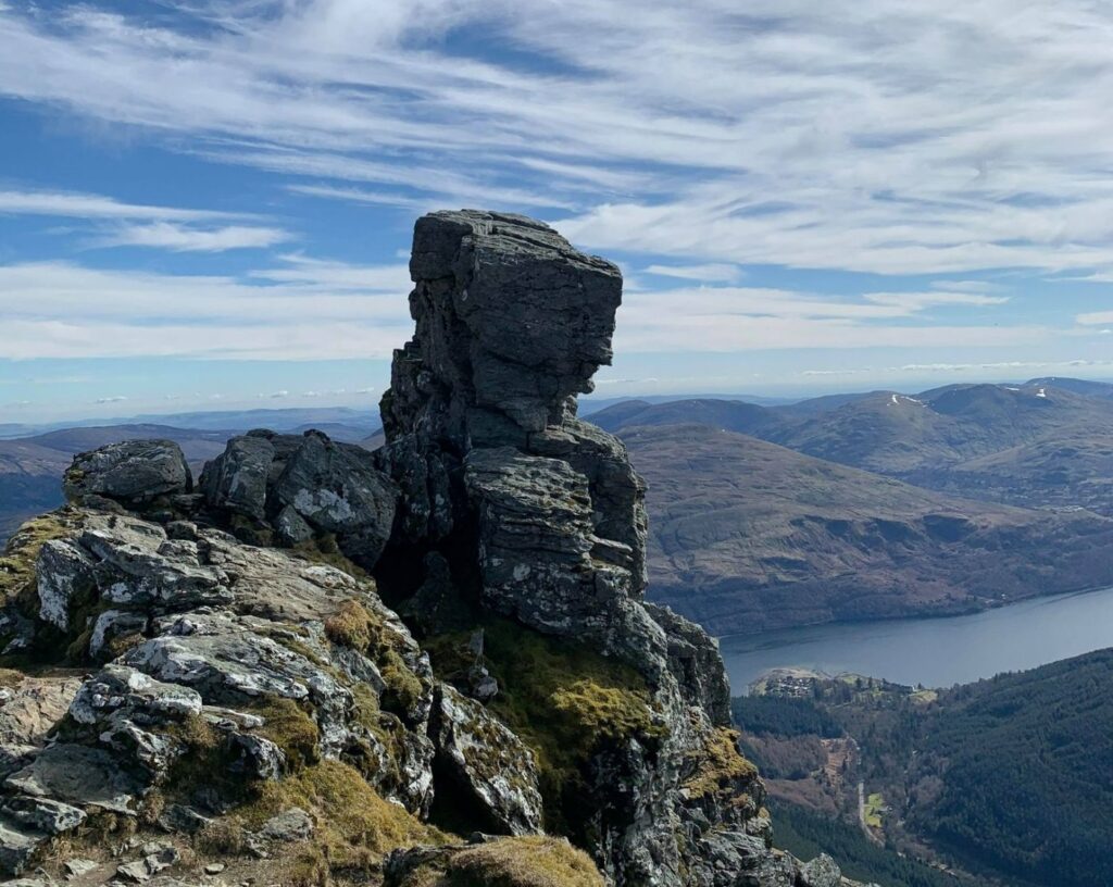
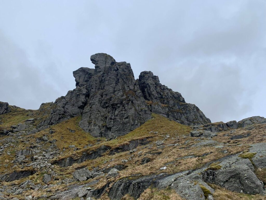
Ben Arthur – The Cobbler
Distance: 11km
Time: 4 – 6 hours
One of the most distinctive hills in Argyll, Ben Arthur, also known as the Cobbler by locals, is a popular mountain in the Arrochar Alps.
- The carpark for this hill walk can be found west of Arrochar, just off the A83. Once you’ve parked and are raring to go, cross the road and find the wide path which will begin your climb to the peak of the Cobbler.
- The main path begins with a series of zigzags. As you climb, bonnie views of Loch Long will come into sight, so have your camera handy.
- Eventually you will come across a bench, the perfect spot to enjoy your morning Scottish oats for breakfast before you continue.
- Continue and turn left on the forestry track, and then right shortly after. Incredible views stretch has far as Ben Lomond in this section.
- Keep walking up the path, which passes through a short section of forestry, before emerging next to a stream. Continue walking straight, until the path veers off to the right as you pass a wee hydro dam.
- You will now have a clear view (unless it’s a driech day) of the three Cobbler peaks – so close yet so far!
- The path continues to climb gently, crossing lovely wee side streams on large steppingstones. Eventually, you will reach the Narnain boulders. These were used as sleeping shelters by groups of climbers who would spend their spare time climbing and did not have the resources for alternative accommodation.
- When you arrive at a fork, stay right and continue up the valley. The lower path to the left is the return route.
- Follow the Allt a’Bhalachain, the sides of the valley will begin to close in a little and the Yawning Crag of Beinn Narnain can be seen on the right-hand side.
- You will arrive at a small lochan, just before the junction of the paths at the top – pop in for a wee dook if yer feelin’ brave!
- The path on the right leads to Beinn Ime and Beinn Narnain. Your route up to the Cobbler turns left and ascends many stone steps.
- You will reach the ridge between the North and Central peaks, turn right to visit the higher, central peak first.
- Take great care if attempting the lower South Peak – it should only attempted by experienced rock-climbers.
- Begin your descent the way you climbed up and follow the path up the other side to explore the North Peak. This peak is a dramatic spot with a small cairn almost above a large overhang – the perfect picnic pitstop.
- The easiest descend is to retrace your steps, however it is quicker though rougher to climb down on the path leading southeast, which is marked with a big pile of stones at the top and with easy stone steps to begin with.
- This path has incredible views back up to The Cobbler’s cliffs and across to the south peak.
- Watch your footing as the patch becomes looser and fairly rocky, you may need to scramble down the gully.
- Eventually you will reach an easier path at the bottom, which soon crosses the stream to join the main path.
- Turn right to rejoin the outward route and follow it back to your starting point.
Beinn Vane
Distance: 11km
Time: 4.5 – 6.5 hours
Whether it’s your first munro or you’re a well-seasoned munro bagger, Beinn Vane is well worth the wee steep rocky sections leading to the summit.
- Park at Inveruglas Visitor Centre, on the west side of Loch Lomond. Here you will find a café and public toilets.
- Begin the walk by crossing the road and turning left on the far side, passing the front of the Inveruglas power station. You should be able to spot giant pipes running down from Ben Vorlich which drive turbines inside.
- Follow the path which curves right onto a track, soon returning to the roadside. After almost 1km, turn right onto a gated tarmac road leaving under a railway.
- You will pass a large electric substation and come to a fork, continue on ignoring the next three left-hand turns.
- Ahead you will see Ben Vane, an impressive rough pyramid of rock and grass. Once beyond Coiregrogain, the tarmac road curves round to the right, bound for the Loch Sloy dam – another part of the hydro power scheme.
- At a signed junction turns off onto a stonier track, crossing a bridge over the river. Four hundred meters beyond the bridge, the track crosses a wee burn. Follow a stepped path which climbs up to reach a low shoulder at the foot of the ridge leading up to Ben Vane.
- Soon you will discover bonnie views stretching over the forestry, Loch Lomond and beyond.
- Continue along a gradual grassy section before the slope steepens again and the path climbs directly up the mountain. This section is steep and rocky, with erosion in places so make sure you’re prepared for a thigh burning workout! As you climb, the ridge becomes more defined.
- Eventually you will reach a flat summit area, the highest cairn is at the eastern end. The view from here is given great depth by the shape of the mountain – towards Loch Lomond it is stunning and there are higher peaks all around.
- You can continue to descend the steep west ridge before ascending to the Glas Bhealach and Ben Ime, however this route is tough and for experienced climbers only.
- To reach the base, return the way you climbed up.
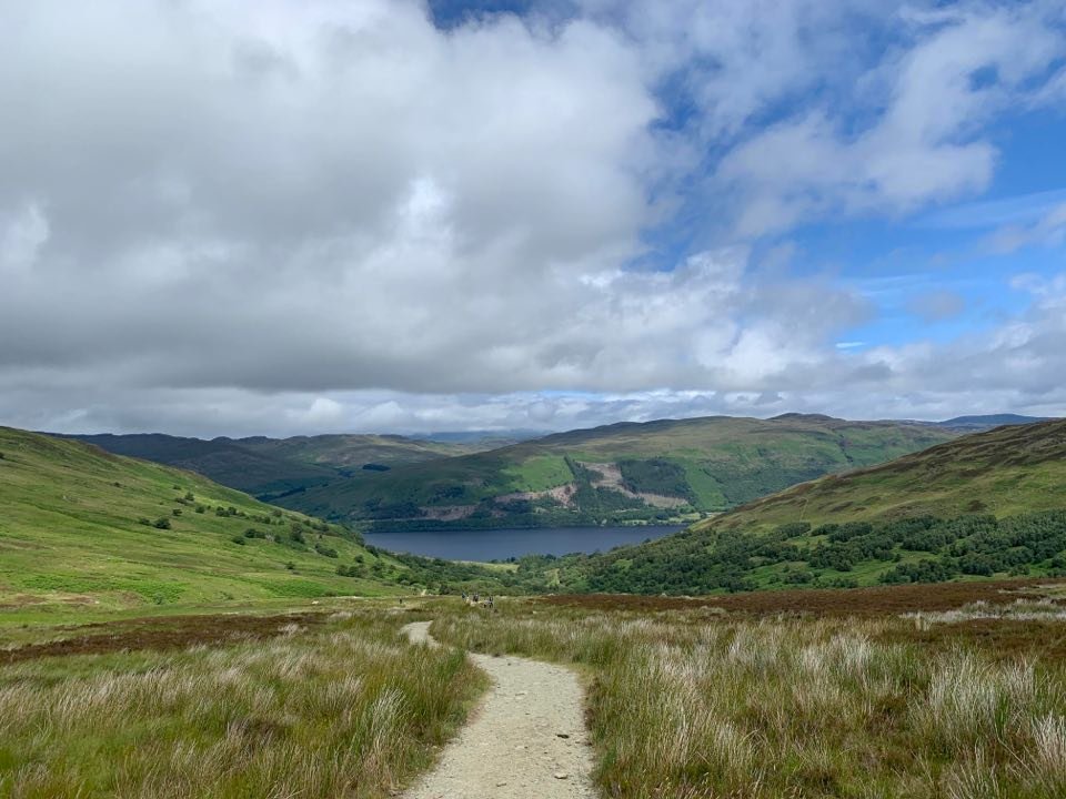
Beinn Vorlich
Distance: 14.5km
Time: 6 – 7 hours
Beinn Vorlich is a popular munro on the southern fringe of the Highlands above Loch Earn. Once at the summit, hikers are rewarded with incredible views of the lowlands below.
- Along the southside of Loch Earn, west of the hump-backed bridge over the Ardvorlich burn, there are sections of road verges which many use as parking spaces for this hike.
- Begin by walking along the track on the opposite side (east) of the burn, passing between the urn-topped stone gateposts.
- Keep right at the fork below the wee farm cottages, crossing the bridge back to the west side of the burn. From here, you will see Ardvorlich House. Once you have crossed the bridge, turn left.
- Hop over stiles along the way. After around 1.5km, veer right as the path forks. A little further on, you will cross the Allt a’Choire Bhuidhe via a footbridge.
- As you ascend, the path becomes increasingly eroded as it leads up the Sgiath nam Tarmachan ridge. A final stepper climb half leads up towards the summit ridge.
- You will spot the trig point at 985m, with the cairn a wee bit further east along the ridge. From here you will have earned beautiful views of central Scotland.
- To climb down, return the same way you came up.


